Who We Are
James Anderson Company established the Lake County Land Survey Company in 1984 as a subsidiary of its civil engineering and land surveying firm that was founded in 1845. Fourth-generation family business owner James G. Anderson has served as the company's president since 1992. Over the years, he has become widely known and recognized for his meticulous attention to detail and tremendous local knowledge.
|
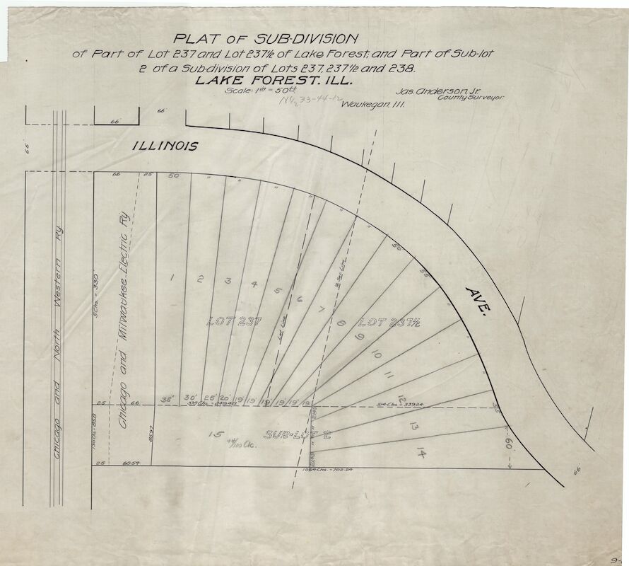
Lake County Land Survey Company holds a unique position among land survey firms in northern Illinois with its ability to take advantage of over one hundred years of the James Anderson Company’s proprietary survey records. These records include a vast number of the earliest Lake County private and municipal surveyor records. While all surveyors are charged with "following in the footsteps of previous surveyors," our extensive archives allow us to follow an enormous variety of footsteps, including those long thought to have vanished.
|
|
Lake County Land Survey has further built upon this vast library of surveying records by continuing to provide multifaceted professional surveying services throughout southern Wisconsin and northern Illinois. We find that these records are vital when property owners, developers, title firms, attorneys, or municipalities encounter survey difficulties thought to be unsolvable. There is likely no more comprehensive resource for those seeking survey and title information in northern Illinois.
Who we Serve
Our team of professional surveyors provides a wide variety of land surveying services for public and private clients, including almost every party engaged in real estate transactions and land development.
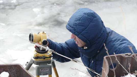
Cadastral (boundary), Topographic, and Hydrographic Survey
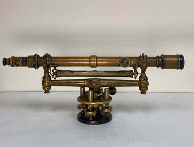
We use our state-of-the-art equipment to establish and re-confirm all types of property and occupation lines, government section lines, easement lines, and to reestablish boundary monumentation. We also provide topographic surveys that may include detailed studies of existing, often dilapidated, underground improvements, slope and steep-slope studies, cross-sections, profiles, steep-slope setback line calculations, stormwater detention calculations, hydrographic surveys, wetland studies and delineations, and floodway/floodplain calculations and depictions.
|
|
Geodetic Control Surveys
Lake County Land Survey Company can provide control surveys based on the client's chosen (or needed) data. We have provided these control surveys for municipalities, aerial photography clients, railroads, and private and commercial clients.
Engineering Inspection Services
Lake County Land Survey Company also employs accomplished engineering inspectors. In an extension of our land survey capabilities, we further evaluate projects for site grading compliance, observe water, sanitary, and storm sewerage improvement constructions, exterior building constructions, the placement of pavement, sidewalk, decks, patios, etc., and provide final inspection "punch lists."
|
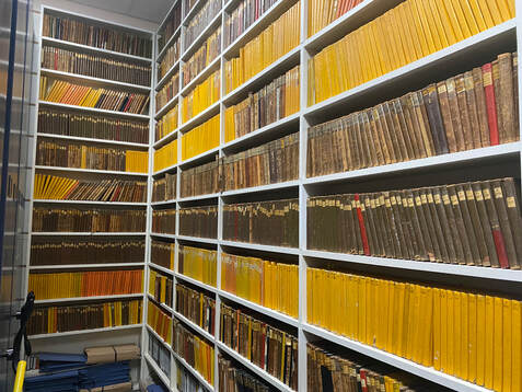
FIELD SURVEY BOOKS SPANNING A CENTURY
|
Additional Lake County Land Survey professional services preparing:
|
|